Why low Earth orbit satellites are becoming essential infrastructure

• A new generation of low Earth orbit (LEO) satellites is shifting Earth observation from periodic imaging to continuous, all-weather monitoring. Synthetic aperture radar (SAR) enables reliable imaging, while very low Earth orbit (VLEO) improves resolution and reduces latency.
• Hanwha Systems is advancing SAR resolution along a roadmap from 1-meter to 15-centimeter-class imaging in VLEO. AI-based image analysis converts raw satellite data into decision-ready insights for defense, disaster response, and environmental monitoring.
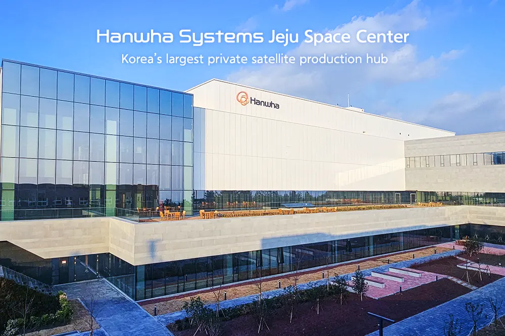
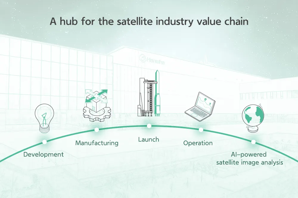
• The Jeju Space Center, the largest private satellite production facility in South Korea, integrates satellite development, manufacturing, testing, and analysis into a single value chain while supporting a broader domestic space industry cluster.
From retreating glaciers and shifting coastlines to ground subsidence and carbon emissions, many of the changes that matter most on Earth develop slowly and quietly. Disasters often only appear sudden because their warning signs went undetected. As global risks accelerate and decision windows shrink, governments, industries, and infrastructure operators face mounting pressure to identify those signals earlier and respond faster. Meeting that challenge requires observation systems capable of monitoring the Earth continuously, reliably, and at increasingly high levels of precision.
A new generation of satellites is changing how we observe the planet, making it possible to detect subtle changes earlier, monitor infrastructure continuously, and deliver near real-time insights regardless of weather or time of day.
This next chapter of Earth observation is being shaped by three key technologies: synthetic aperture radar (SAR), low Earth orbit (LEO) satellite constellations, and AI-driven analysis. Together, they are transforming satellites from systems that periodically capture images into platforms capable of delivering operational intelligence in near real time.
How SAR is enabling a new chapter of Earth observation
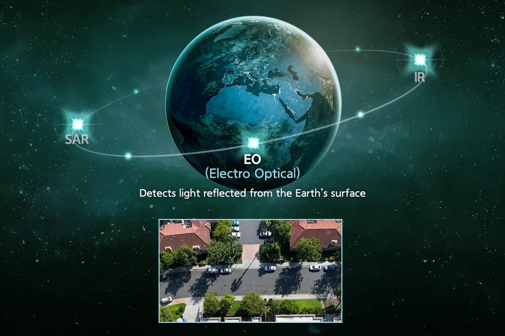
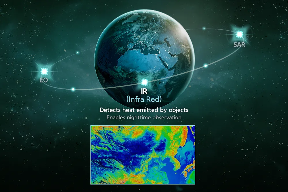
The most familiar Earth observation systems use electro-optical sensors that capture visible light. The imagery is clear and intuitive, but observation becomes difficult at night, and cloud cover can completely obscure the surface. Infrared sensors can operate in darkness by reading differences in heat, but thick clouds or dense fog weaken the thermal signal. For applications that need consistent monitoring, from maritime surveillance to disaster response, these gaps in coverage can last hours or days.
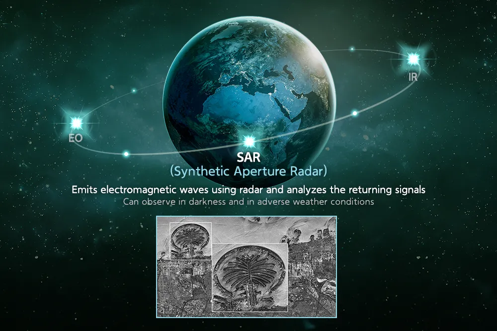
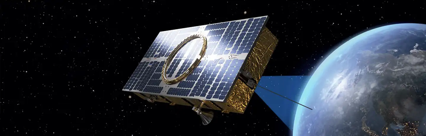
SAR overcomes those limits by using radar signals rather than visible light. Radar wavelengths penetrate cloud and fog, enabling consistent data collection regardless of weather or time of day. In 2023, Hanwha Systems launched South Korea’s first privately developed SAR satellite, achieving 1-meter-class resolution capable of capturing infrastructure such as bridges, rivers, and airports. Its integrated design combines the payload, main body, and solar panels into a single unified structure, reducing weight and volume so that more satellites can be loaded onto a single launch vehicle. That efficiency is essential for the satellite constellations needed to move Earth observation from intermittent imaging toward reliable, repeatable detection of change.
Satellite observation methods
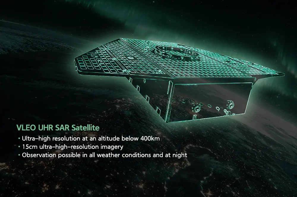
VLEO and the next level of observation performance
As observation systems evolve, performance is increasingly defined by how precisely and quickly satellites can capture and deliver data. Very low Earth orbit (VLEO), defined as altitudes below 400 kilometers, improves on both fronts. The shorter signal distance produces stronger return signals, clearer imagery, and lower latency, enabling faster transmission of detected changes and supporting time-sensitive decisions. For applications from maritime domain awareness and border security to disaster assessment, the difference between a 30-minute data delay and a near-real-time feed can determine whether a response is preventive or reactive.
VLEO refers to the orbit, while SAR refers to the sensor type, and the two are increasingly being combined. Hanwha Systems is advancing SAR resolution along a defined roadmap, from 1-meter to 50-centimeter, 25-centimeter, and ultimately 15-centimeter-class, ultra-high-resolution SAR in VLEO. Each step changes what the data can reveal. A 1-meter system identifies the presence of a vehicle. At 50 centimeters, it distinguishes a car from a truck. At 25 centimeters, lane markings and surface damage become visible. At 15 centimeters, objects the size of a mobile phone or a water bottle can be identified from orbit. The result is a step change in actionable insight, with the same all-weather reliability that SAR provides.
From data to decisions: AI and integrated observation systems
As sensing and orbital capabilities improve, the value of Earth observation depends increasingly on how effectively data is processed, analyzed, and translated into usable intelligence. A high-resolution satellite produces limited value if the imagery it captures cannot reach decision-makers in operationally relevant timeframes.
If satellites act as the sensing layer, AI is what allows the data they collect to be interpreted and applied at operational speed. Hanwha’s AI-based satellite image analysis solutions are designed to turn raw imagery into decision-ready insights, supporting applications from target identification and disaster damage assessment to environmental monitoring.
This reflects a broader shift toward integrated systems, where satellites, ground infrastructure, and data platforms operate as a coordinated network rather than standalone assets. Hanwha is building this capability across the full value chain, from satellite development and manufacturing through launch, control, and AI analysis. Completed in December 2025, the Jeju Space Center is the largest private satellite production facility in South Korea, with capacity to assemble and test up to 100 satellites per year. On-site infrastructure verifies satellite performance under vacuum, extreme temperatures, and electromagnetic conditions, and the facility anchors a wider space industry cluster connecting Jeju, Goheung, Suncheon, and Changwon.
What does Earth observation suggest about future infrastructure?
As demand grows for real-time intelligence across environmental monitoring and critical infrastructure management, satellite systems will play a larger role in enabling visibility across industries and decision environments. The greatest value will come from systems that can connect the full chain, from orbit to analysis to application.
The future of Earth observation will be defined not only by what satellites can see, but by how clearly the signals they capture can be understood and acted on. Space technology is evolving from observation as a capability to observation as a system for reading the Earth more closely, and responding to its changes sooner.


Get the latest news about Hanwha, right in your inbox.
Fields marked with * are mandatory.
- Non-employee
- Employee